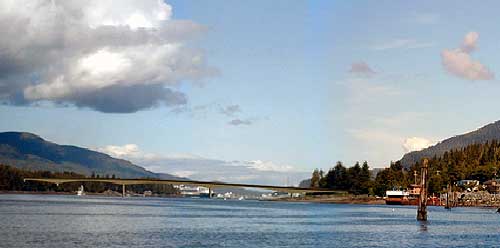
 Pennock Island Crossing 60-foot High Bridge East Channel and 200-foot High Bridge West Channel Ketchikan, Alaska Photos Courtesy Gravina-Access Project Published: 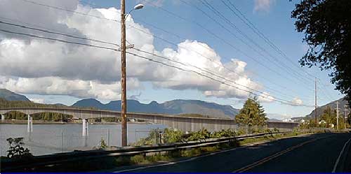 Alternative F3 crosses Pennock Island and the east and west channels of Tongass Narrows. This alternative would start at Tongass Avenue south of the U.S. Coast Guard Base and north of the Forest Park Subdivision and cross the east channel of Tongass Narrows to Pennock Island with an approximately 18-meter (60-foot) high bridge. The alternative would cross Pennock Island at grade and then use a second 61-meter (200-foot) high bridge over the west channel to Gravina Island. The horizontal clearance of the west channel bridge would be approximately 198 meters (650 feet) wide. The west channel bridge is designed to accommodate larger cruise ships. From the west channel bridge, the road would continue northward approximately 9.5 kilometers (5.9 miles) to the north end of the Airport Reserve property. An airport access road would be constructed at the south end of the airport runway and turn northward to the airport terminal. The road at the south end of the runway would be constructed at a grade low enough to allow for future runway expansion plans; i.e., the runway would be expanded as an overpass of the road.
 of Tongass Narrows to Pennock Island. 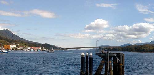 of Tongass Narrows to Pennock Island. 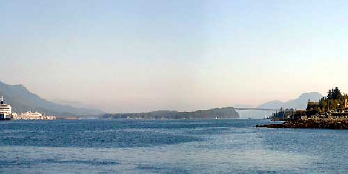
The EIS is assessing the no-action alternative and nine build alternatives: two 200-foot high bridge crossings near the airport (Alternatives C3[a] and C4), two 120-foot high bridge crossings near the airport (Alternatives C3[b] and D1), a combined 200-foot high/120-foot high bridge crossing that incorporates Pennock Island (Alternative F1), a combined 60-foot high/200-foot high bridge crossing that incorporates Pennock Island (Alternative F3), and three ferry alternatives (Alternatives G2, G3, and G4).
Photo Essay 1 - East Channel High Bridge - Alternative F1 a combined 200-foot high/120-foot high bridge crossing that incorporates Pennock Island (published March 02, 2003) Photo Essay 2 - Alternative F3 Pennock Island Crossing 60-foot High Bridge East Channel and 200-foot High Bridge West Channel Photo Essay 3 - Alternative C3A Photo Essay 4 - Alternative C3B Photo Essay 5 - Alternative C4: 200-foot High Bridge Airport Area to Cambria Drive Area Photo Essay 6 - Alternative D1: 120-foot High Bridge Airport Area Ferry Alternatives: (Alternatives G2, G3, and G4)
A special thank you to the Gravina Access Project Team for providing these photographs & information.
Source of Information:
|