 Who Drew the Lines and Why By June Allen April 22, 2003
While there was genuine concern in Ketchikan over the blockade, nothing seems to dampen the Alaskan sense of humor for long. Bar room jokes were based on how to tell a Canadian fish from an Alaskan fish, and included recipes for baking sockeye salmon in-the-round (whole) to appreciate the pretty red maple leaf on the fish's tail fin. When the delayed Malaspina finally docked at Ketchikan, its next regular port of call, the ferry's captain and crew were temporary celebrities as they told their stories of the exceptional encounter in Prince Rupert. The southernmost ocean portion of the invisible Alaska-Canada border line is noted on maps as an "indefinite" boundary as it juts out into Dixon Entrance just south of Prince of Wales Island. But the ownership of 785 square miles of Dixon Entrance between Prince of Wales Island and Canada's Queen Charlotte Islands with some of the best salmon fishing grounds in the world has long been disputed by fishermen on both sides. The man-made border does not, the critics still say, take into account the migration patterns of spawning fish. Little or no conflict arises these days at the international boundary stations on terra firma, the long land boundary that divides Alaska and Canada. It is encountered without incident at four places on highways that cross the border - at Hyder; out of Haines; out of Skagway, and where the Alaska Highway (Alcan) crosses from Yukon Territory into Alaska. Alaskans have always considered Canadians to be good neighbors. But that's not always been the case in return. There are still deep Canadian resentments against the U.S. about all the historic boundary negotiations of the past. The most recent of the formal decisions were reached in a 1903 Boundary Tribunal Treaty that stands to this day. That tribunal was to decide if the 1825 boundary drawn by the Russians and British back in 1825 needed major changes. It was decided by a lop-sided tribunal vote that it didn't need major changes, a fact that angered the Canadians who very much thought changes were needed! Before that early 1825 Anglo-Russian line was drawn, Russian America was too far geographically removed from the rest of the world to elicit much notice. The Russian-Alaska territory roughly included the huge but largely unknown northern shoulder of the North American continent plus the narrow strip of Southeastern mainland and islands that edged southward to approximately 54-40 degrees latitude. It seems no one realized then the magnitude and wealth of the unmapped and uncharted areas involved. 
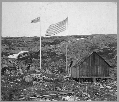
While there was one Russian colony in California - Fort Ross near San Francisco - the main settlements in Russian America were at Sitka and Kodiak, although there were permanent trading posts in the Copper River area, on the Kenai, in the Aleutians, on the fur seal islands of the Bering Sea and all along the major rivers and coastlines of the Bering sea. There seemed to be little or no need for a political boundary between the Russian claims and the Canadian lands until the early 1800s when the Hudson's Bay Company, fur trading competitor of the Russian-America Company, paddled its way to the western edge of Canada. Suddenly there was a need for a boundary to define what land and/or belonged to whom. It became clear that there was a need for a Russian-America and British boundary treaty. In the meantime, the world was growing smaller and the time had come when colonizing nations were considering the concept of "We won't butt into your hemisphere if you'll stay out of ours!" What colonies the nations already owned would stay their own but no new colonization should be attempted. The U.S. called its policy the Monroe Doctrine. That Anglo-Russian treaty of 1825, among other issues, drew a boundary between Alaska and Canada that was almost identical to today's. Its differences were that its drafters knew little or nothing about the geography of the terrain. It was known back then only that a chain of mountains followed the coast northward. The boundary therefore was to follow the "crest of the mountains situated parallel to the coast" and should not anywhere exceed the distance of 10 marine leagues (whatever that is in miles) from the ocean. At a point roughly north of Mount St. Elias the boundary then followed the 141st degree of longitude straight up northward to the "Frozen Ocean." That was a very general description but it served its purpose well enough with one exception. That part about "should not anywhere exceed the distance of 10 marine leagues from the ocean" was to cause trouble later on. What exactly defined "ocean," became the troubling question. Did it mean 10 marine leagues from the entrances of bays and inlets or from the heads of those bodies of water. But that was not seriously questioned until the Alaska Gold Rush of '98! The first "discovery claim" of that gold rush was actually in Canada's Klondike, no argument there. But to get there required sailing into Alaska waters and crossing Alaska land to get to the Klondike. Suddenly the U.S. became aware of the potential of its heretofore ignored northern possession and took a sudden interest in the boundary issue. The potential resource wealth of these heretofore ignored regions became paramount in politicians' minds. It was decided that an Alaska Boundary Tribunal was necessary. 
His Britannic Majesty Edward VII appointed Sir Richard Webster, Baron Alverstone, Lord Chief Justice of England; as well as Sir Louis Amable Jette, Lt. Gov. of the Province of Quebec, and Allen Bristol Aylesworth, one of the King's Counsel. Those three represented the crown. Meeting in January of 1903, all six negotiators agreed that the line of commencement should begin at Cape Muzon. They also "unanimously" agreed that the line should then follow Portland Canal. Then there followed a series of "majority" decisions rather than unanimous decisions as Lord Alverstone - for some reason - voted with the Americans! Canadian interests and wishes were obviously ignored by the King's biggest gun. It meant that the distance to the Canadian border would be measured from the heads of the saltwater bays, inlets, etc. rather than from the entrances. That left Canada virtually landlocked north of Prince Rupert. Small wonder that the Canadians felt cheated. And, considering that Teddy Roosevelt had appointed his Secretary of War to the Tribunal, it shouldn't be surprising that Canadians believed and some still believe that Roosevelt threatened to declare war on Canada if the U.S. wishes on boundary questions were denied. That's how it happened, that's the story, why Canadians get angry. It seems everyone is agreed on where that murky saltwater line in Dixon Entrance is located - except for the salmon! Since the 1997 Malaspina incident at Prince Rupert, however, some of the knottier problems between Americans and Canadians in the waters of Dixon Entrance have been negotiated and ironed out.
©2003 Chris Wilhelm I never done no body any harm I only lied about the details, the ones that got away Never kept any shorter than my arm Where God rest his soul every blessed day We lay up in Bar Harbor and retire every autumn I wouldn't have it any other way When the ferry Malaspina couldn't go All the fishermen in Prince Rupert made a chain of boats around her And Alaska ferries couldn't make the show Politicians start in the big debates All those sockeyes Yanks are catchin' are wearin Vancouver fashion No fish ever wore no license plates They had fish to unload at the Rupert docks But the docks weren't acceptin, the fish were close to rejectin' So the skipper of the 'Lady' skipped the talks This ain't no way to treat your fellow man. "My boat's long and beamy, you better run when you see me, I'm gonna drive this boat straight back to Ketchikan Where God rest his soul every blessed day We lay up in Bar Harbor and retire every autumn I wouldn't have it any other way No body bettin on the Rupert boats Their gauntlet soon was scattered, free trade was all that mattered And those ferries returned to their normal routes Where God rest his soul every blessed day We lay up in Bar Harbor and retire every autumn I wouldn't have it any other way All Rights Reserved Not to be reprinted in any form without the written permission of Chris Wilhelm.
All rights reserved. Not to be reprinted in any form without the written permission of June Allen.
|
||||